

Trending Now
 PM Modi inaugurates Noida International Airport, Boosting North India’s Multi-Modal connectivity
 Things You Can Do While on Long Train Rides: Stay Productive, Relaxed, and Entertained
 Rail Chamber launches 2026–27 National Membership Drive to strengthen Asia’s Railway Ecosystem
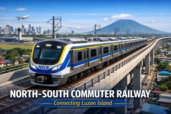 North-South Commuter Railway (NSCR): Modern Train Network Connecting Luzon Island
 India launched Bharat Taxi Service as First Cooperative-Owned Digital Mobility Platform
 India places World’s First Live Commercial Order for Hyperloop-Based Cargo Logistics
 How Weigh-in-Motion Systems Are Revolutionizing Freight Safety
 Women Powering India’s Electric Mobility Revolution
 Rail Chamber Launched to Strengthen India’s Global Railway Leadership
 Wage and Hour Enforcement Under the Massachusetts Wage Act and Connecticut Labor Standards
Google Maps launches "stay safe feature" for shared mobility users
SuperAdmin
Posted on: 2019-06-27 08:54:02
Viewer: 1,490
Comments: 0
Country:
City:
How to use Stay Safer feature on Google Maps
- Now, after searching for your destination and getting directions, you can enable this experience by selecting the “Stay safer” and “Get off-route alerts” option.
- If your driver deviates more than 0.5 km from the Google Maps suggested route, your phone will buzz with a prominent notification, and you can tap it to see where you are compared to the original route.
- Then, you can also choose to share your live trip with friends and family directly from that screen so they know you are off route and can keep track of your journey, and take appropriate action, if required.
Through our extensive research across India, we found that a lot of people limit their mobility due to safety-related concerns. To address this, we are launching another India-first feature that will deliver a more relevant and reliable experience to our users. Our new ‘Stay Safer’ feature on Google Maps will alert users who are travelling in taxis, auto-rickshaws, etc. in case their vehicle goes off route, giving them peace of mind.
Other Useful Public Transport Features
Apart from this, Google has also recently launched three new public transport features including live train status, bus travel times derived from live traffic and mixed-mode commute suggestions that now combine auto-rickshaw and public transport in India.Simplifying travel on public transport buses
Google Maps can now tell you about your bus travel times based on live traffic. This uses the power of Google’s live traffic data and public bus schedules to calculate delays and provide accurate travel times. This is the first product of its kind launching first in India enabling you to know how long your bus trip will take when factoring in live traffic conditions. This feature is launched in Delhi, Bangalore, Mumbai, Hyderabad, Pune, Lucknow, Chennai, Mysore, Coimbatore, and Surat.
To use this feature, enter your starting location and destination, then tap the transit tab. The results for bus travel times from live traffic will include the time in green (when running on time) or red (when delayed.)
Real-time train information for long-distance trains
Google Maps can now help you know when your train will arrive by indicating the real-time status. Search for your starting location and destination, or your starting station and destination to see a list of trains that you can take between the routes. From there, you can easily see the real-time status, and whether any of them are delayed, right inside Google Maps. This feature was developed in partnership with the Where is My Train app that Google acquired last year.
Mixed-mode directions results that include auto-rickshaws
We’re excited to announce directions support in Maps for journeys that combine auto-rickshaw and public transport. The public transport tab on Google Maps for Android will now tell you when taking such a journey is a good option, how long it will take, which station you should take an auto-rickshaw to/from. You can also see the rickshaw meter estimate, and departure times for your transit connection. This feature will be available for Delhi and Bangalore initially and will soon be extended to more cities.


SuperAdmin